Logo of Sazy Lanka

Natural & Scenic Hill Country

Spectacular

Sri Lanka's Hill Country is the most magical part of the entire country.

The hill country is a world away from the rest of Sri Lanka, with tangled green mountains rise from every quarter, their lower slopes swathed in verdant tea bushes. Spectacular waterfalls plunge over cliffs into valleys hemmed in between high mountainsides. The cloud forest above is alive with the secretive chirrupings of elusive mountain birds.
KNUCKLES MOUNTAIN RANGE

Knuckles Mountain Range

The Knuckles Mountain Range lies in central Sri Lanka, in the Districts of Matale and Kandy. The range takes its name from a series of recumbent folds and peaks in the west of the massif which resemble the knuckles of clenched fist when viewed from certain locations in the Kandy District. Whilst this name was assigned by early British surveyors, the Sinhalese residents have traditionally referred to the area as Dumbara Kanduvetiya meaning Mist-laden Mountain Range.
The higher montane area is often robed in thick layers of cloud. In addition to its aesthetic value, the range is of great scientific interest. It is a climatic microcosm of the rest of Sri Lanka as the conditions of all the climatic zones in the country are exhibited in the massif. At higher elevations there is a series of isolated cloud forests, harboring a variety of flora and fauna. Although the range constitutes approximately 0.03% of the island’s total area, it is home to a significantly higher proportion of the country’s biodiversity. The isolated Knuckles range harbors several relict, endemic flora and fauna that are distinct from central massif. More than 34 percent of Sri Lanka’s endemic trees, shrubs, and herbs are only found in these forests.
Natural and Scenic Hill Country

Nuwara Eliya

Nuwara Eliya is a city in the hill country of the Central Province, Sri Lanka. Its name means “city on the plain (table land)” or “city of light”. The city is the administrative capital of Nuwara Eliya District, with a picturesque landscape and temperate climate. It is at an altitude of 1,868 m (6,128 ft) and is considered to be the most important location for tea production in Sri Lanka. The city is overlooked by Pidurutalagala, the tallest mountain in Sri Lanka. Nuwara Eliya is known for its temperate, cool climate — the coolest area in Sri Lanka.
The town’s attractions include the golf course, trout streams, Victoria Park, and boating or fishing on Lake Gregory. Victoria Park is an attractive and well-used oasis. It is popular with birdwatchers at quieter times because of the good opportunities for seeing species, particularly the Indian blue robin, pied thrush or scaly thrush lurking in the denser undergrowth. The Kashmir flycatcher is another attractive bird species in the park.
Horton Plains National Park

Horton Plains National Park

Horton Plains National Park is a protected area in the central highlands of Sri Lanka and is covered by montane grassland and cloud forest. This plateau at an altitude of 2,100–2,300 meters (6,900–7,500 ft) is rich in biodiversity and many species found here are endemic to the region. This region was designated a national park in 1988. It is also a popular tourist destination and is situated 8 kilometers (5.0 mi) from Ohiya, 6 kilometers (3.7 mi) from the world famous Ohiya Gap/Dondra Watch and 32 kilometers (20 mi) from Nuwara Eliya.
The Horton Plains are the headwaters of three major Sri Lankan rivers, the Mahaweli, Kelani, and Walawe. In Sinhala the plains are known as Maha Eliya Plains. Stone tools dating back to Balangoda culture have been found here. The plains’ vegetation is grasslands interspersed with montane forest and includes many endemic woody plants. Large herds of Sri Lankan Sambar deer feature as typical mammals and the park is also an Important Bird Area with many species not only endemic to Sri Lanka but restricted to the Horton Plains. Forest dieback is one of the major threats to the park and some studies suggest that it is caused by a natural phenomenon. The sheer precipice of World’s End and Baker’s falls are among the tourist attractions of the park.
Kitulgala

Kitulgala

Kitulgala is a small town in the west of Sri Lanka. A rain forestry area, which gets two monsoons each year, and is one of the wettest places in Sri Lanka. Nevertheless, it comes alive in the first three months of the year, especially in February, the driest month. The Academy Award-winning movie The Bridge on the River Kwai was filmed on the Kelani River near Kitulgala, although nothing remains now except the concrete foundations for the bridge Kitulgala is the base for white-water rafting in Sri Lanka.
Large numbers of people make the excursion from Colombo at weekends to enjoy the beautiful scenery, play in the river, Jungle Walks, Adventurous water fall jumps/ slides, White Water Rafting and have an excellent rice and curry lunch at the local restaurants.
This area has most of the rainforest bird species that are found at the World Biosphere Reserve at Sinharaja, although in lower numbers. However, the secondary forest and cultivation at Kitulgala is more open than the pristine woodlands of Sinharaja, and elusive endemic species like Sri Lanka Spurfowl, Green-billed Coucal and Spot-winged Thrush may be easier to see. So Kitulgala is a primary spot for bird watching enthusiasts.
Adam's Peak

Adam’s Peak

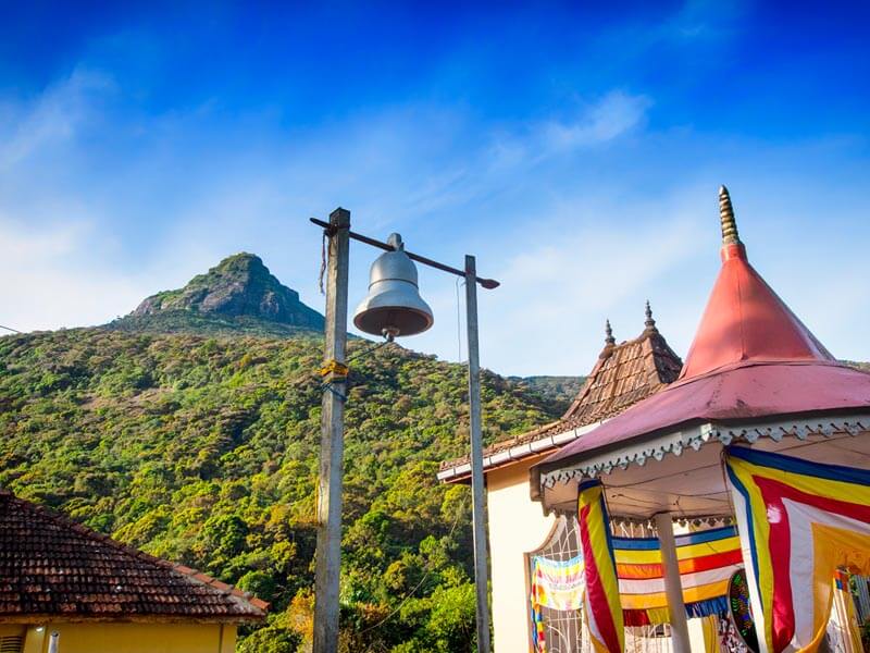
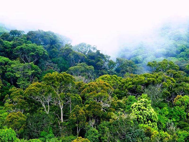
Adam’s Peak – Sri Pada or Samanalakanda, (Butterfly Mountain) is a 2,243 m (7,359 ft) tall conical mountain located in central Sri Lanka. It is well known for the Sri Pada, “sacred footprint” rock formation near the summit, which in Buddhist tradition is held to be the footprint of the Buddha, in Hindu tradition that of Shiva and in Islamic and Christian tradition that of Adam, or that of St. Thomas. Adam’s Peak is important as a watershed. The districts to the south and the east of Adam’s Peak yield precious stones—emeralds, rubies and sapphires, for which the island has been famous, and which earned for its ancient name of Ratnadvipa.
The pilgrim’s season to Sri Pada traditionally starts on the full moon of December and ends on the full moon of April. It takes a while for the crowds to build up but by the second half of the season they can be very large so it is best to go earlier. Weekends and particularly full moon days are always crowded and should be avoided. Most people make the climb at night so they can arrive in time for the sunrise.
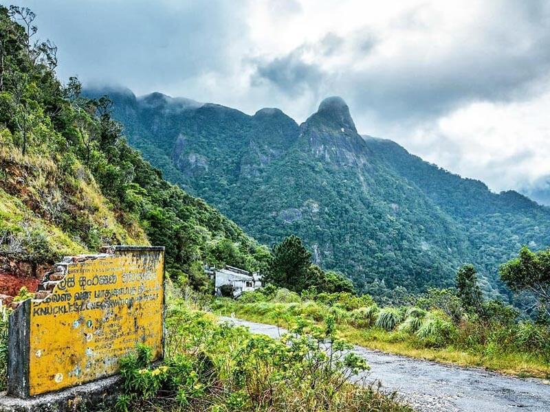
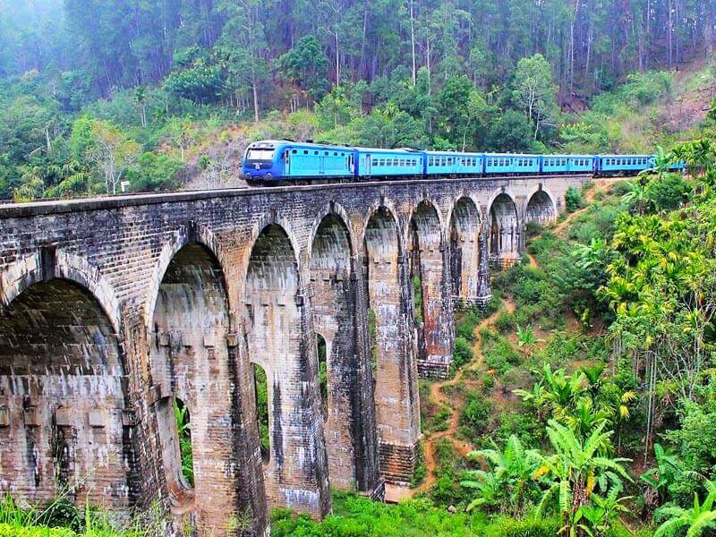
Access to the mountain is possible by 6 trails: Ratnapura-Palabaddala, Hatton-Nallathanni, Kuruwita-Erathna, Murraywatte, Mookuwatte & Malimboda. The usual route taken by most pilgrims is ascent via Hatton and descent via Ratnapura; although the Hatton trail is the steepest, it is also shorter than any of the other trails by approximately five kilometers.
Nine Arch Ella

Ella and Around

Ella is a beautiful small backpacker-hub on the southern edge of Sri Lanka’s Hill Country. It has become to go-to town in the hill country for tourists and as a result has a reasonably well-established tourism-orientated economy. For example, there is espresso coffee and fish and chips on offer, as well as lounge/backpacker -style bars aimed solely at the visitor.
It’s situated in the middle of beautiful countryside, with small vegetable plots in the valleys, tea plantations on the hill slopes and forests on the tops. The climate throughout most of the year is typical of the high Hill Country, with a hot sun by midday, but a moderate air temperature. It will often rain in the afternoon, but only for an hour or so. A sweatshirt, or light jacket is needed at night. In December it can rain a lot!
Walk up to Ella’s Rock, about 2 hours (each way) along the railway track and through the tea plantations, for stunning views across the countryside. The first 1.5km is along the railway track itself so keep an ear out for oncoming trains although they travel so slowly you’ll have plenty of time to get out of the way. The fog tends to move in by 10am, so get an early start for the best views. Early start may be ideal, but not essential. Rawana Ella Falls are about 5km away on the road south through Ella Gap. Demordara Bridge Also called the Nine Arches Bridge is a famous bridge situated between Ella and Demordara railway stations.
Sinharaja Rain Forest

Sinharaja Forest Reserve

Sinharaja Forest Reserve is a national park and a biodiversity hotspot in Sri Lanka. It is of international significance and has been designated a Biosphere Reserve and World Heritage Site by UNESCO.
The hilly virgin rainforest, part of the Sri Lanka lowland rain forests ecoregion, was saved from the worst of commercial logging by its inaccessibility, and was designated a World Biosphere Reserve in 1978 and a World Heritage Site in 1988. The reserve’s name translates as Lion Kingdom.
The reserve is only 21 km (13 mi) from east to west, and a maximum of 7 km (4.3 mi) from north to south, but it is a treasure trove of endemic species, including trees, insects, amphibians, reptiles, birds, and mammals. Because of the dense vegetation, wildlife is not as easily seen as at dry-zone national parks such as Yala. There are about 3 elephants and the 15 or so leopards are rarely seen. The most common larger mammal is the endemic purple-faced langur.
An interesting phenomenon is that birds tend to move in mixed feeding flocks, invariably led by the fearless greater racket-tailed drongo and the noisy orange-billed babbler. Of Sri Lanka’s 26 endemic birds, the 20 rainforest species all occur here, including the elusive red-faced malkoha, green-billed coucal and Sri Lanka blue magpie.
Reptiles include the endemic green pit viper and hump-nosed vipers, and there are a large variety of amphibians, especially tree frogs. Invertebrates include the endemic common birdwing butterfly and the inevitable leeches.